 ...........................................................................................................

Analysis
Assessing chronological trajectories per subregion based on selected key sites:
Assessing chronological trajectories per subregion based on selected key sites:
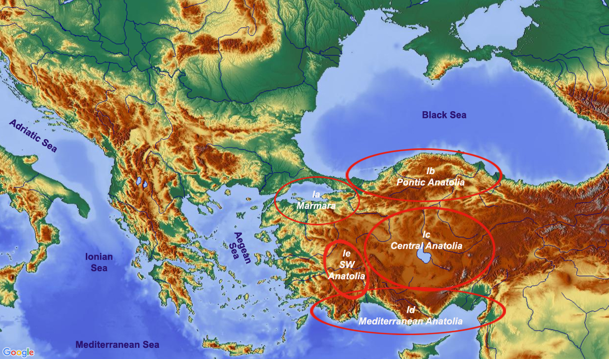
Region I – Anatolia
 Ia Marmara Ia Marmara
 Ib Pontic Anatolia
Ic Central Anatolia
Id Mediterranean Anatolia
Ie Southwest Anatolia Ib Pontic Anatolia
Ic Central Anatolia
Id Mediterranean Anatolia
Ie Southwest Anatolia |
|
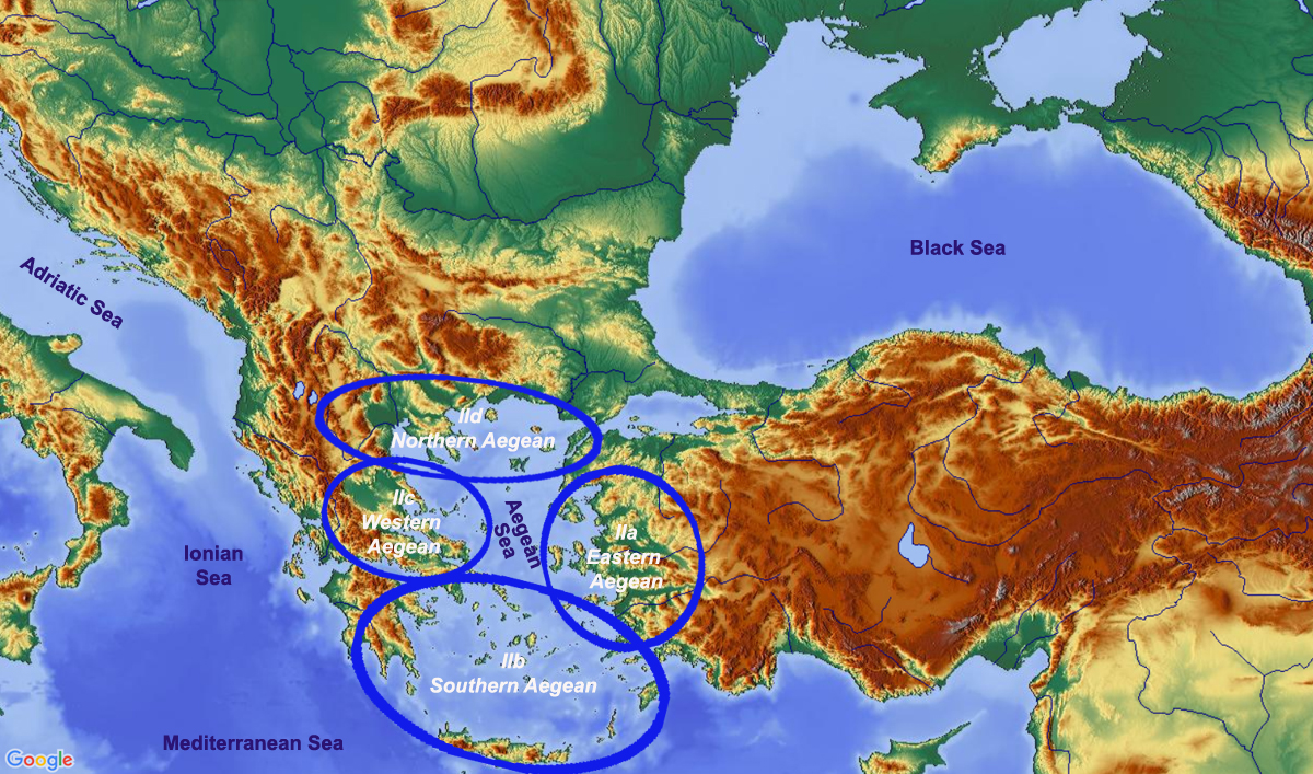
| Region II – The Aegean
IIa–d Transition Mesolithic–Neolithic
IIa Eastern Aegean
IIb Southern Aegean
IIc Western Aegean
IId Northern Aegean |
|
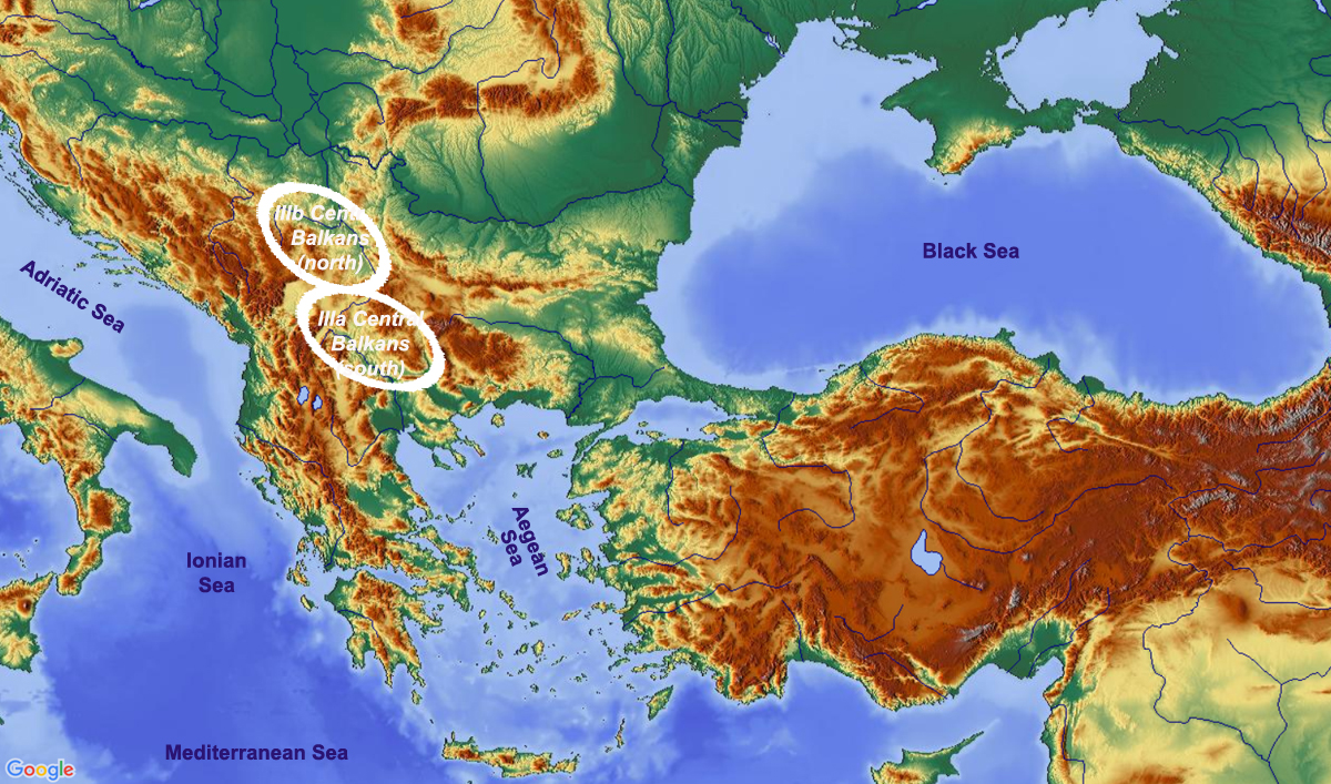
| Region III – Central Balkans
IIIa Central Balkans South
IIIb Central Balkans North |
|
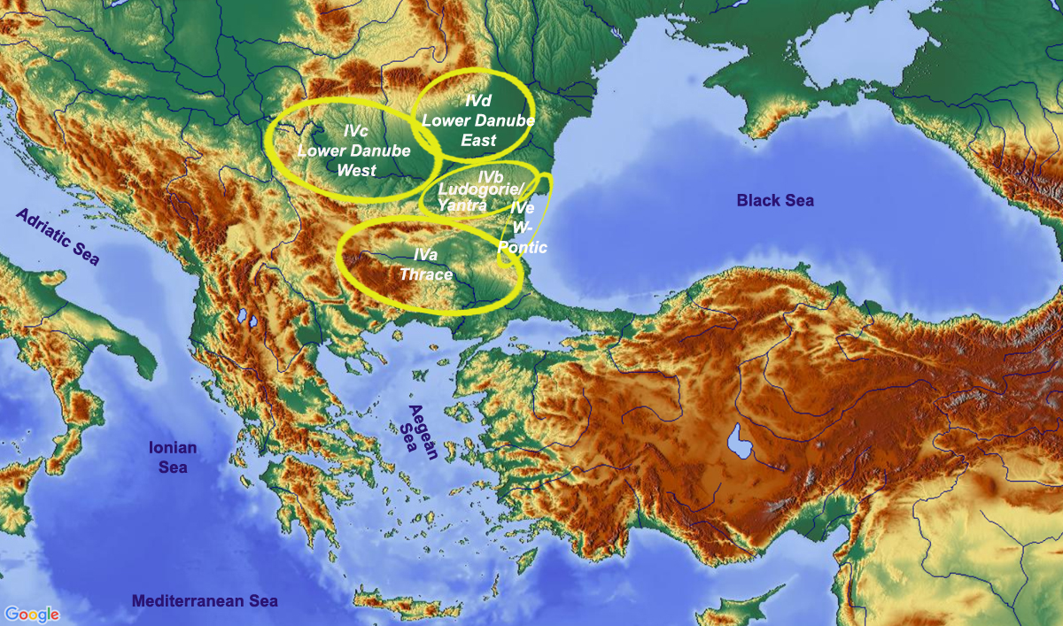
| Region IV – Eastern Balkans
IVa Thrace
IVb Ludogorie Plateau
IVc Lower Danube West
IVd Lower Danube East
IVe West Pontic |
|
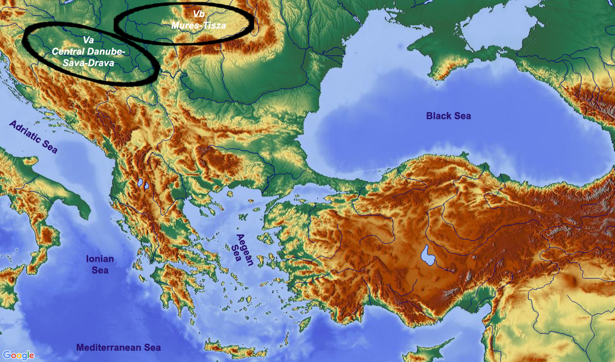
| Region V – Southern Carpathian Basin
Va Middle Danube-Sava-Drava
Vb Mureş-Tisza |
|
| Region VI – Northwest Pontic
VIa Coastal steppe
VIb Forest steppe |
|