
 .................................................................................................................................................


Region V – Southern Carpathian Basin
Geography
The eastern part of the Pannonian Basin, east of the Danube River, is framed by the Carpathians (in the north, east and southeast) and by the Dinaric Alps (in the south). According to its river systems two distinctive areas can be defined (see Figure 1): The eastern river system is dominated by the Tisza River that is collecting most of the waters deriving from Transylvania and the Banat – apart from the Olt that is discharging into the Danube. The confluence of the rivers Tisza and Maros/Mureş is (for the moment) describing the northern limit of our working area. Further north, the Körös-Criş River basin of the northeastern Alföld is part of the westernmost reaches of the Pontic steppe.
Southern Central Europe is therefore described by the western river system of the Middle Danube and the rivers Sava and Drava discharging into it (Subregion Va). The eastern part is defined by the rivers Maros/Mureş and Timiş (Subregion Vb).
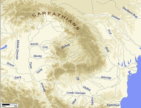
Figure 1. Map of southern and eastern Central Europe
Sites (n=40)
| Va: Middle Danube-Sava-Drava | Vb: Mureş-Tisza |
| Banjica | Cerişor-Cauce Cave |
| Bapska | Daia Română |
| Belovode | Deszk-Olajkút 1 |
| Gomolava | Dudeştii Vechi |
| Gornja Tuzla | Foeni-Cimitirul ortodox |
| Lupljanica | Foeni-Gaz |
| Opovo | Foeni-Sălaș |
| Petnica | Giulvăz |
| Selevac | Gura Baciului |
| Starčevo-Grad | Gyálarét-Szilágyi Major |
| Uivar | Hodoni |
| Vinča-Belo Brdo | Limba Bordane |
| Lumea Nouă | |
| Maroslele-Pana | |
| Miercurea Sibiului-Petriș | |
| Ocna Sibiului | |
| Orăştie-Dealul Pemilor | |
| Parța | |
| Parța 2 | |
| Perlez-Batka 'C' | |
| Röszke-Lúdvár | |
| Sajan-Domboš | |
| Sȃnandrei | |
| Satchinez | |
| Şeuşa-La Cărarea Morii | |
| Tărtăria | |
| Vršac-At | |
| Zau de Câmpie |
Geography
The eastern part of the Pannonian Basin, east of the Danube River, is framed by the Carpathians (in the north, east and southeast) and by the Dinaric Alps (in the south). According to its river systems two distinctive areas can be defined (see Figure 1): The eastern river system is dominated by the Tisza River that is collecting most of the waters deriving from Transylvania and the Banat – apart from the Olt that is discharging into the Danube. The confluence of the rivers Tisza and Maros/Mureş is (for the moment) describing the northern limit of our working area. Further north, the Körös-Criş River basin of the northeastern Alföld is part of the westernmost reaches of the Pontic steppe.
Southern Central Europe is therefore described by the western river system of the Middle Danube and the rivers Sava and Drava discharging into it (Subregion Va). The eastern part is defined by the rivers Maros/Mureş and Timiş (Subregion Vb).
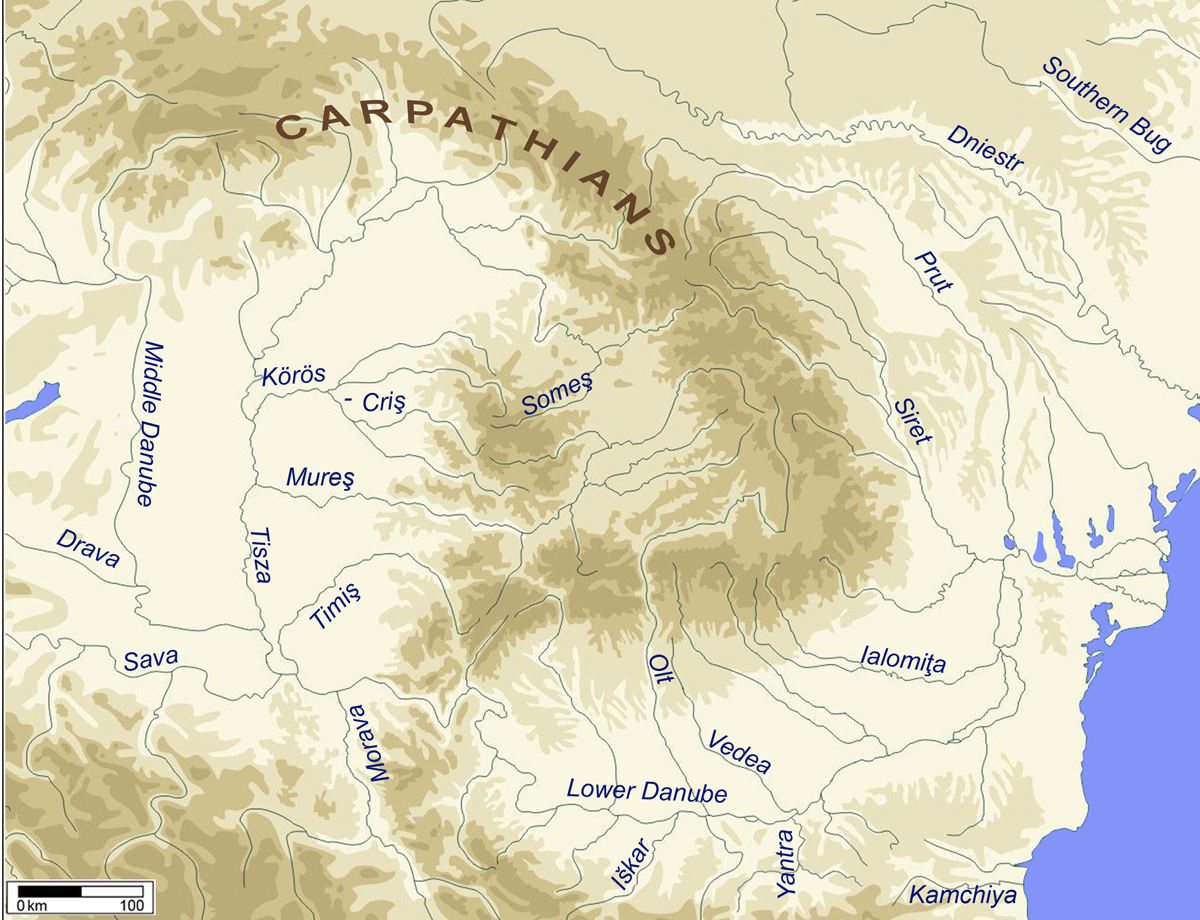
Figure 1. Map of southern and eastern Central Europe
 up
up